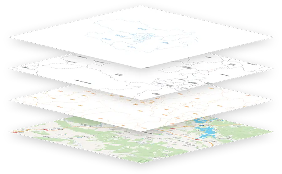
Background information

Real-time data and forecasts for mobility without surprises

Comprehensive reporting of historical traffic data

TomTom traffic data updated every minute

Data

  • Continuous traffic status map, including all roads.
  • Road incidents, including traffic jams, accidents, road works, weather incidents, etc.
  • Travel times between different points, updated based on current traffic conditions.
  • Monitoring a route: obtaining the evolution of the traffic status of the different sections of one or more roads.
  • Cercalia enriches the reports by providing the road code and the initial / final KP.

Datos estadísticos

Advanced traffic information

Traffic data for specific dates and time slots from the TomTom Move web portal. Nexus enriches the reports by providing the track code and the initial / final KP. Types of reports available:

  • O/D matrices.
  • Traffic Stats.
  • Junction Analytics.
  • Reports by track and kilometre point sections.

Weather

Meteorological data

Weather forecast information and current weather conditions, including:

  • 5-day weather forecast.
  • Real-time precipitation radar.
  • Weather-related road incidents.

POIs

Massive database of points of interest

Cercalia offers you a database of points of interest organised by categories: transport, education, health, food, services and more.

Types of use available:

  • Layer of POI markers to paint on the map.
  • POIs closest to a location, by category, with actual proximity.
  • List of POIs that come within an area (polygon).
  • POIs along a route (e.g. rest or service areas, petrol stations, hotels, etc.).
Descarga las capas y agrégalas a tu base de datos

Data download

Download the GIS layers you need

Download geometry and GIS data from anywhere in the world:

  • Download polygons of municipalities and postcodes.
  • Download main roads.

Geo-customised solutions

Do you have any questions or need a Cercalia API key?

Contact our sales team.

contacta con ventas